
3D Maps and 3D City Coverage
3D Maps


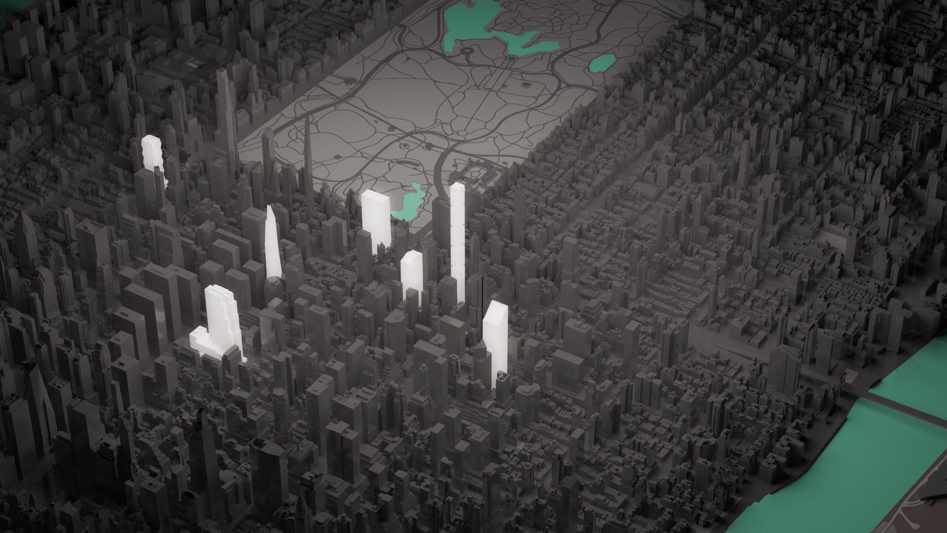
Base 3D Map
USD 400
from existing city models
Timing
by the next day
Add-ons:
USD 100+
• Colored overlays for properties/areas
• Textured highlights for select properties
• Street names, Transportation overlays
What to include in the brief?
• Screenshot for viewing angle confirmation (preferably from Google Maps 3D/Satellite)
• Image size and orientation (default is 8.5×11″/A4 landscape)
• Please advise your Edgite representative if you require editable overlays (.AI file)
• Any details/source files for the highlights, especially if the specifics are still under development.
Custom 3D Maps
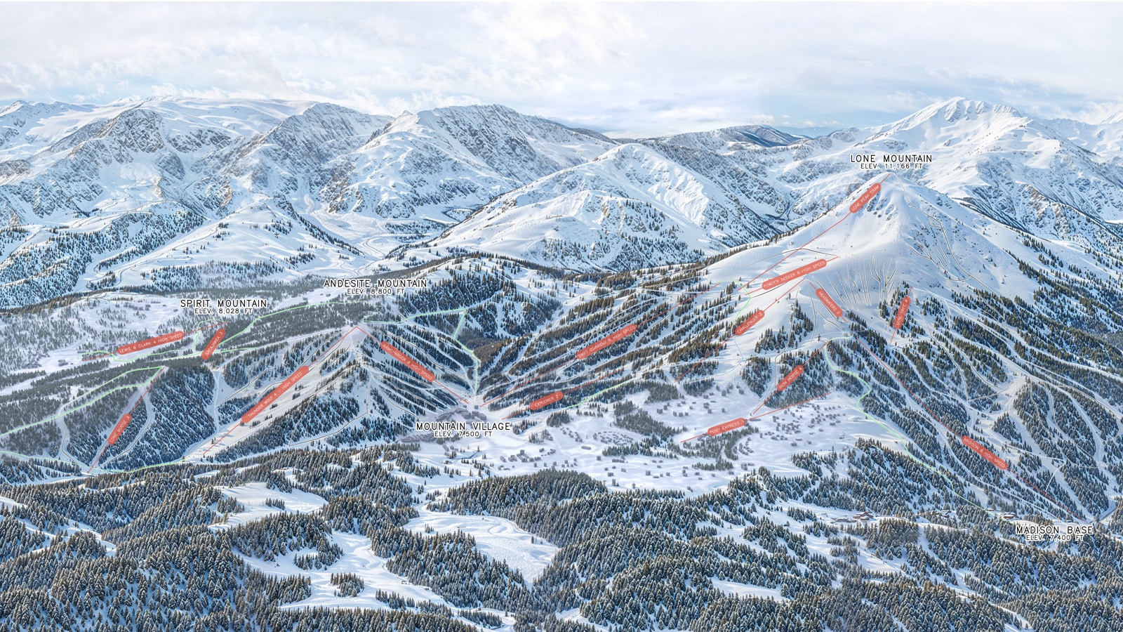
Custom 3D/Terrain Map via 2D/3D Data
USD 1 000
from third-party data, for most locations
Custom 3D/Terrain Map via Imagery
USD 2 000
from satellite imagery for any location worldwide
Timing
3 days
Add-ons:
USD 100+
• Colored overlays for properties/areas
• Textured highlights for select properties
• Street names, Transportation overlays
What to include in the brief?
• Screenshot for viewing angle confirmation (preferably from Google Maps 3D/Satellite)
• Image size and orientation (default is 8.5×11″/A4 landscape)
• Please advise your Edgite representative if you require editable overlays (.AI file)
• Any details/source files for the highlights, especially if the specifics are still under development.
USD 1 000
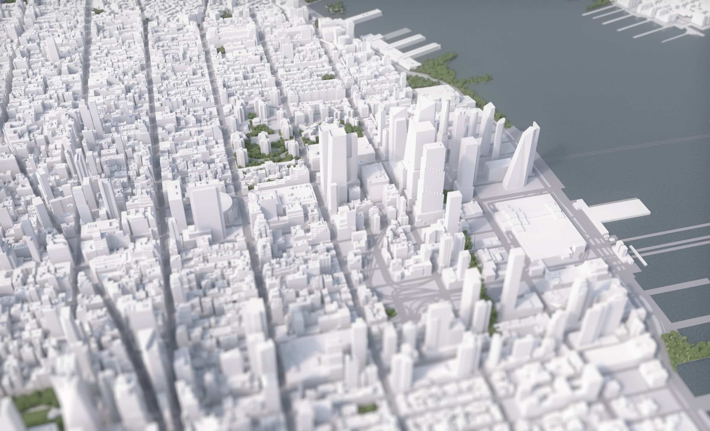
Textured 3D Maps


Photogrammetry 3D Map
USD 400
from commercially released Photorealistic 3D Tiles via Cesium – coverage is the same as Google Maps 3D
Timing
by the next day
Satellite Overlay 3D Map
USD 1 000
based on 3D city models and commercial satellite imagery – coverage is limited, satellite sourcing cost varies
Timing
2 days
Add-ons:
USD 100+
• Colored overlays for properties/areas
• Street names, Transportation overlays
What to include in the brief?
• Screenshot for viewing angle confirmation (preferably from Google Maps 3D/Satellite)
• Image size and orientation (default is 8.5×11″/A4 landscape)
• Please advise your Edgite representative if you require editable overlays (.AI file)
• Any details/source files for the highlights, especially if the specifics are still under development.
Addons: Detailed Highlights

Basic Building Model
USD 50/ EACH
• with simplified features, limited textures/materials
Advanced Building Model
USD 250/ EACH
• with 3D modeled details/features
Timing
1-2 days
Price and timing can vary significantly based on building complexity. Level of detail specified for bird’s-eye view only. We can add Detailed Building Models free of charge if an Exterior Rendering or 3D Stacking Plan is also requested. Consult your Edgite representative for your project specifics.
What to include in the brief?
Any details/source files for the highlights, especially if the specifics are still under development.
3D map pricing, scope & production notes
- 3D data availability
We will confirm whether the requested 3D map is available in our internal 3D data library, covered by third-party datasets, or requires partial or full manual modeling. - Camera angle changes
If additional third-party content sourcing is required, changes to the camera angle after the draft stage may result in an additional charge due to applicable third-party costs. - City model updates and active developments
While we maintain up-to-date 3D city models, we may rely on your input regarding recent or active developments.
When flagged during review, we will include these updates in the 3D map rendering at no additional cost. - Image size and resolution
The default output size is 8.5 × 11 inches at 300 PPI.
Larger formats or higher resolutions may incur additional charges. - Overlay delivery format
Please confirm whether overlays are required as editable files in AI format or baked into the final 3D map output as PNG or JPG. - Expedited turnaround
A 50% surcharge may apply for rush or expedited orders. - Additional cities
Please request a quote for cities not currently listed in our standard coverage. - Custom 3D styles
Pricing for unique 3D visual styles such as night mode, hand-painted, illustrative, or toy-like aesthetics may vary.
Please discuss requirements with your Edgite representative prior to quoting.
3D City Coverage for Base 3D Maps
USA, CANADA
Antioch (CA)
Atlanta (GA)
Austin (TX)
Baltimore (MD)
Boston (MA)
Charlotte (NC)
Chicago (IL)
Concord (CA)
Dallas (TX)
Fremont (CA)
Hayward (CA)
Houston (TX)
Jersey City (NJ)
Kansas City (MO)
Las Vegas (NV)
Los Angeles (CA)
Miami (FL)
Minneapolis (MN)
Nashville (TN)
New Orleans (LA)
New York (NY)
Oakland (CA)
Philadelphia (PA)
Richmond (VA)
San Antonio (TX)
San Francisco (CA)
San Jose (CA)
St. Louis (MO)
Toronto (CAN )
Washington D.C. (DC)
EUROPE, ASIA
Amsterdam (NL)
Berlin (DE)
Belgrade (RS)
Bratislava (SK)
Brussels (BE)
Bucharest (RO)
Budapest (HU)
Cologne (DE)
Copenhagen (DK)
Dortmund (DE)
Dresden (DE)
Florence (IT)
Hong Kong (HK)
Leipzig (DE)
London (UK)
Madrid (ES)
Kuala Lumpur (MY)
Manchester (UK)
Milan (IT)
Monaco (MC)
Munich (DE)
Oslo (NO)
Paris (FR)
Prague (CZ)
Rome (IT)
Singapore (SG)
Sofia (BG)
Sydney (AU)
Taipei (TW)
Tokyo (JP)
Utrecht (NL)
Vienna (AT)
Warsaw (PL)
Zürich (CH)